User Manual ALVAR Service
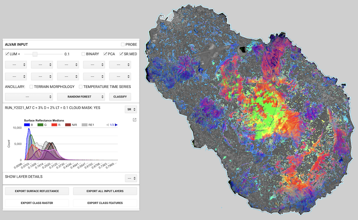
Alvar (rev. 1.0): Ailanthus altissima visual aid for reconnaissance
Alvar (rev. 1.0): Ailanthus altissima visual aid for reconnaissance
Alvar is a Google Earth Engine cloud application aimed at early Ailanthus altissima reconnaissance.
It is based on Copernicus Sentinel-2 optical imagery, available since mid-2015, at 10m ground pixel resolution. The rationale is: each plant species can show peculiar signals in the optical range and, moreover, it can possibly show a time-series signature. Finding the invasive alien A. altissima is in principle feasible, given a characteristic optical spatiotemporal signature. However, even if we can have physiological clues, we do not know such a signature.
Alvar supports the seek for an A. altissima optical signature exploiting the cloud computing capability of fast time series search of the images and the vegetation-related associated optical indices, without the need of local data download.
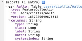
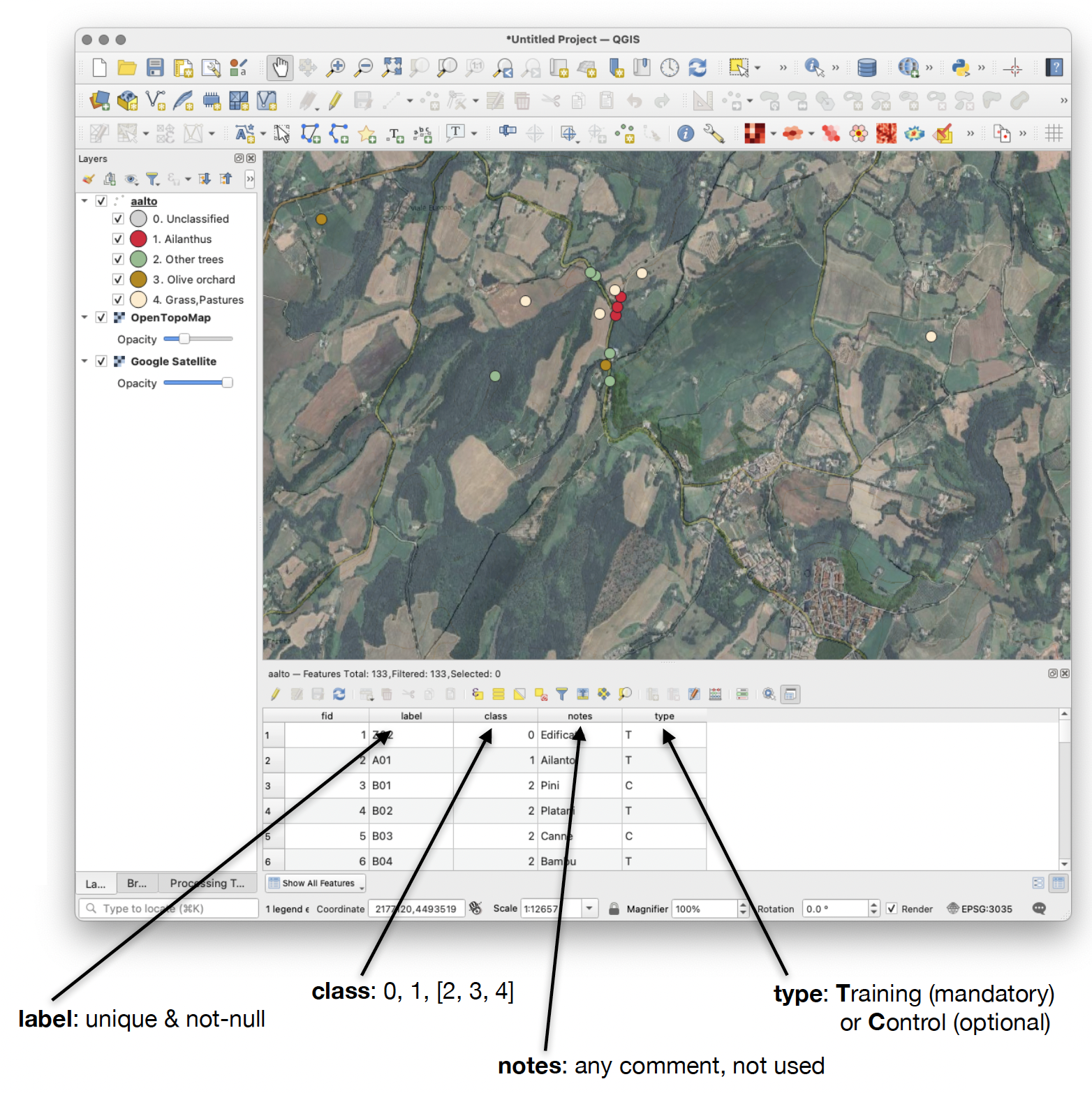
Alvar exploits the machine learning algorithms exposed by the Google Earth Engine APIs, training them by means of a user provided training/control set of empirical observations. A sample set, Aalto, is provided Alvar distribution. The examples in this manual are referred to this Alvar Aalto pair, designing possible classifications based on user choices and machine learning.
The user interface is GUI-based and the intervention on the code consiste only in importing the appropriate training set and tuning the area of interest bounding box accordingly.
The Alvar script is available at https://code.earthengine.google.com/baf3e4144da52ed4e372f6991ca17bf6 and the sample training set at https://code.earthengine.google.com/?asset=users/ciolfis/Aalto
Users must be logged as Google developers in order to use the application.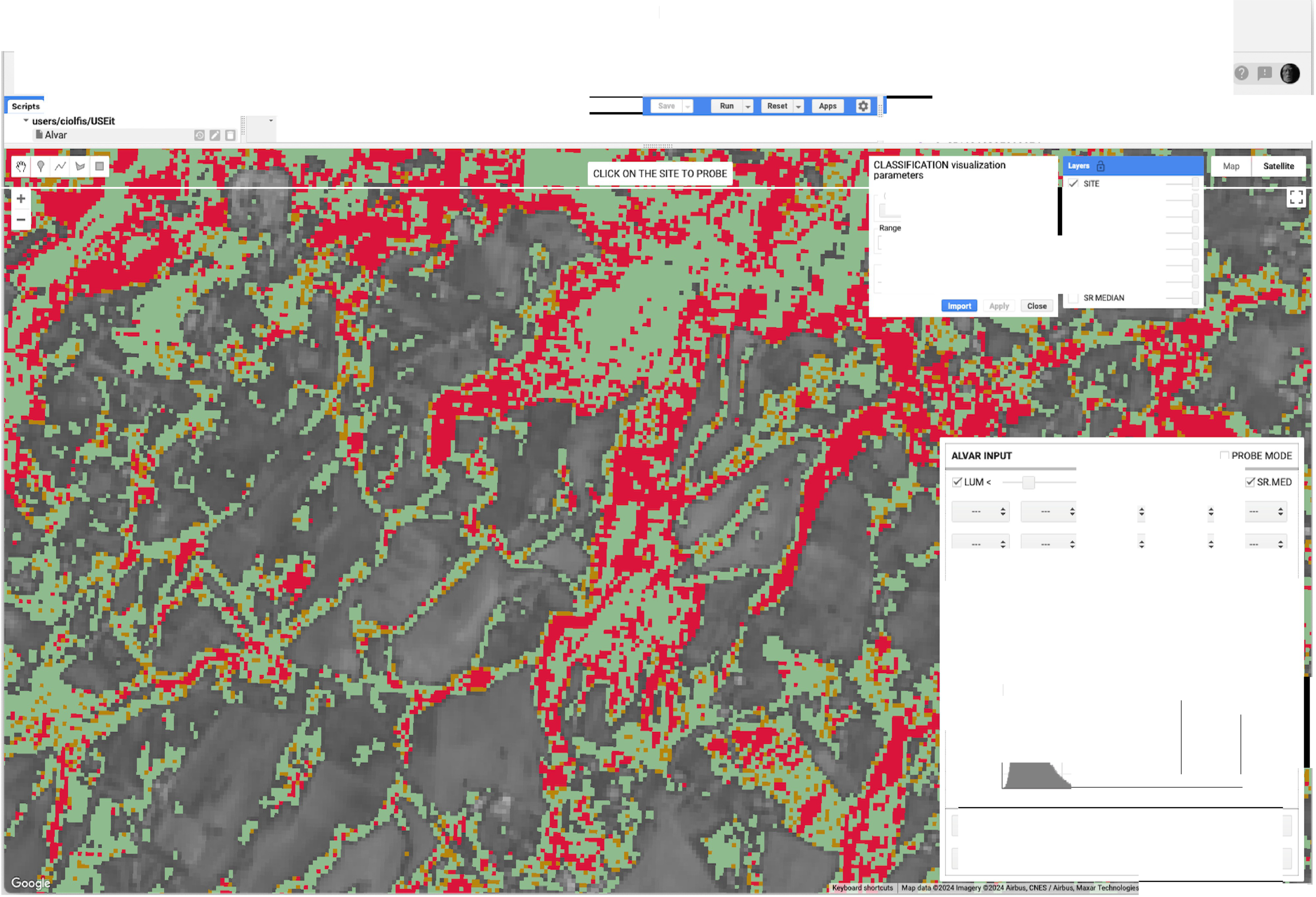
N.B.: Users must be logged as Google developers in order to use the application.
The user interaction is GUI-based. The running times depend on the extension of the area, not much on the number of training and control points provided by the user. Timeouts are possible, depending on the general Google earth Engine load, which is not in user’s control.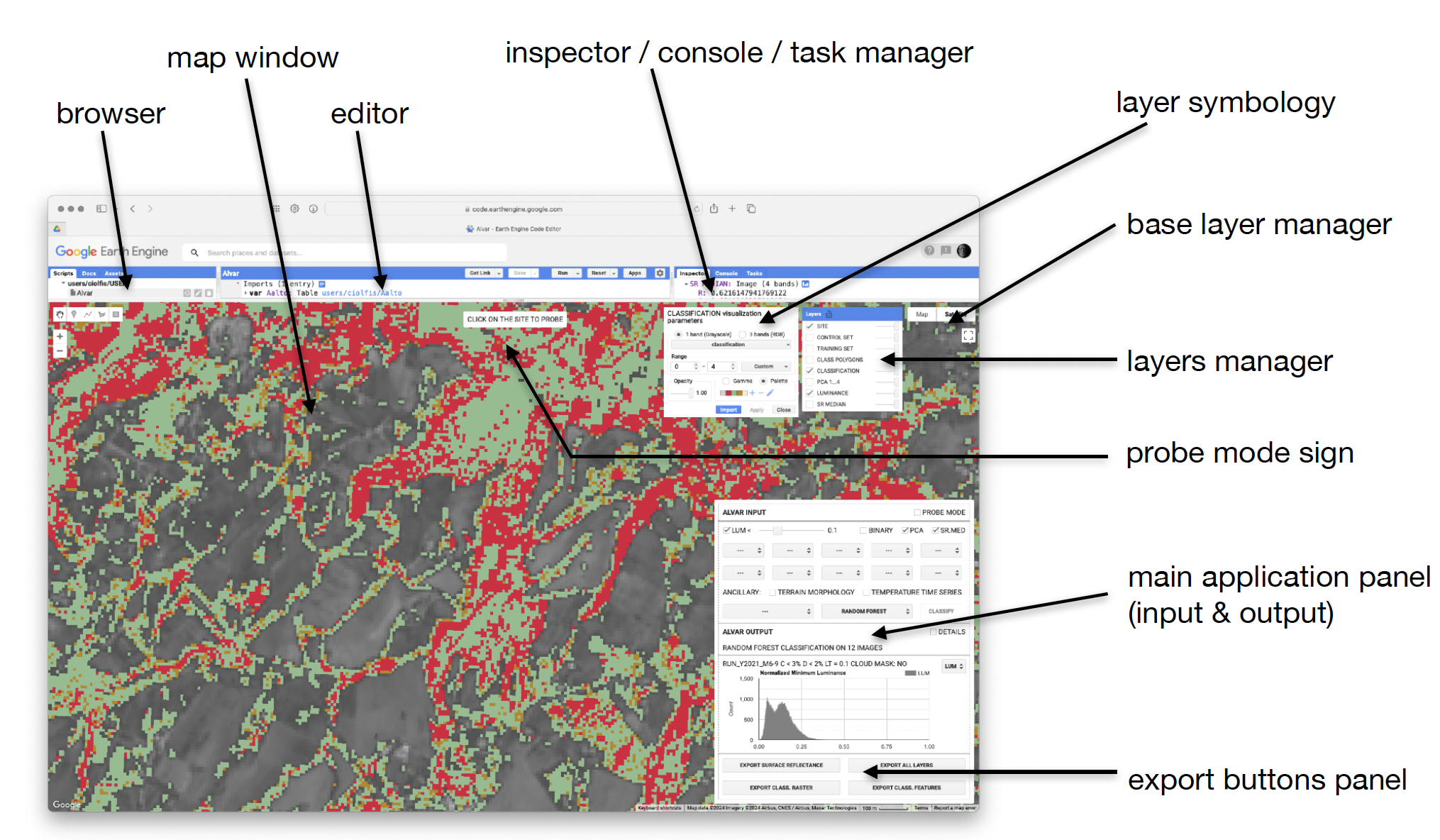
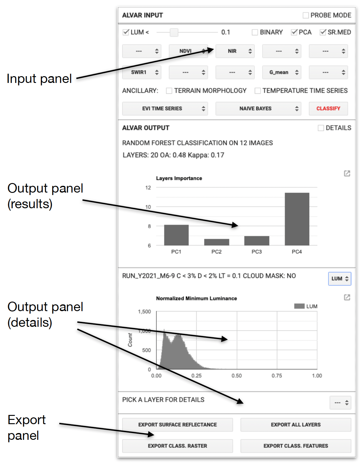 The main panel is where all the action takes place.
The input panel consists in lists of user-selectable image bands and optical indices, all from Sentinel-2 imagery, a menu of time series, and a choice of machine learning algorithms. The classification can be performed on bands, indices, surface reflectance medians, luminance or on the principal components of such layers. A pixel probe shows all the available data at a single site (10 ✕ 10 m pixel).
The output panel consists in a result panel and in a detailed analysis of all the (tens to hundreds of) layers that can be included in the machine learning procedure. the results can be expanded and single points can be probed for a pixel-wise analysis.
Four buttons prepare the export tasks of input and output data. The download process is asynchronous.
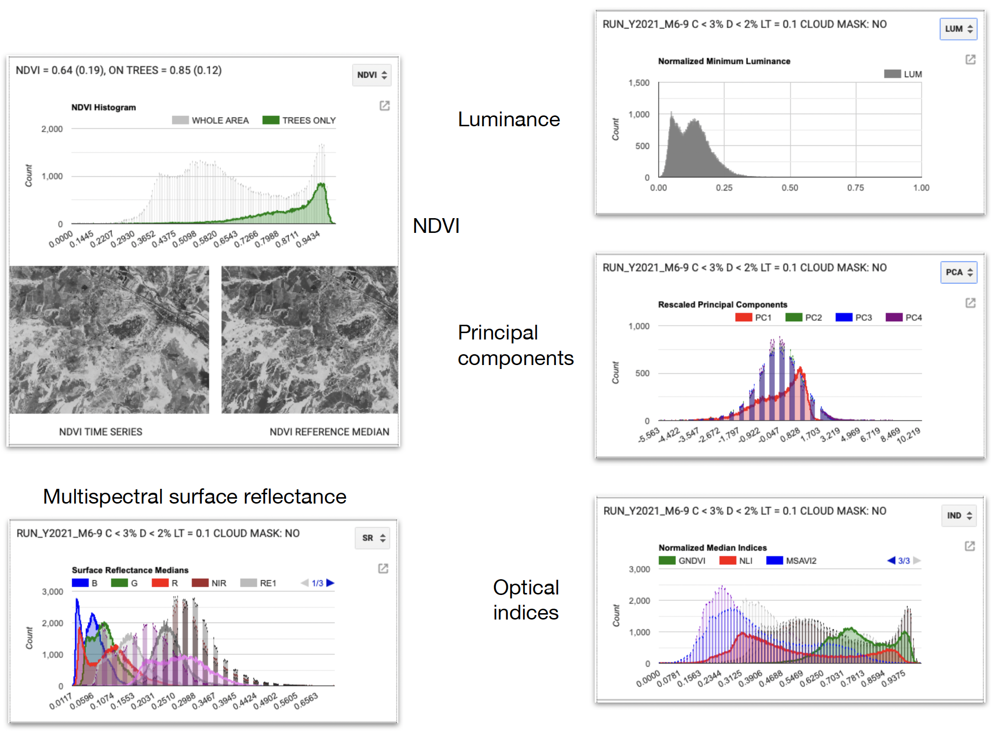
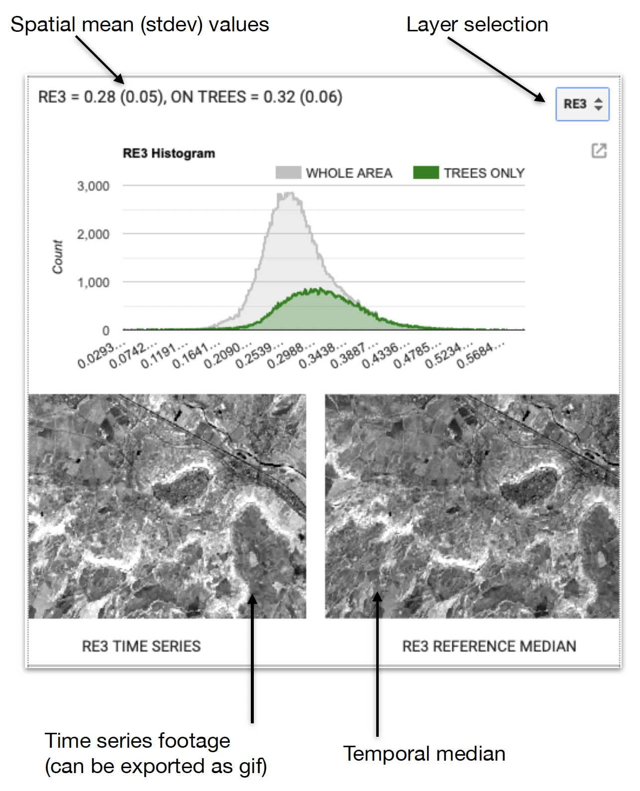 Each Sentinel-2 band and every index can be analysed in detail, in order to find the best suited Alvar input layers.
The analysis can be conducted at the image level, selecting the desired layer, or at the pixel level, activating the probe mode.
As it is the case with all the Google Earth Engine graphs, these can be exported as graphics and csv tables.
A layer movie is also shown, each frame referring to a single timestamp.
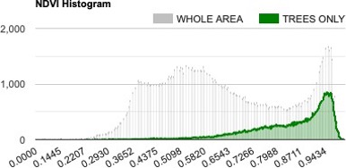
Histograms are computed according to the native 10m pixel resolution, relatively to the forested-only and the whole area.
The interface can be operated in probe mode. 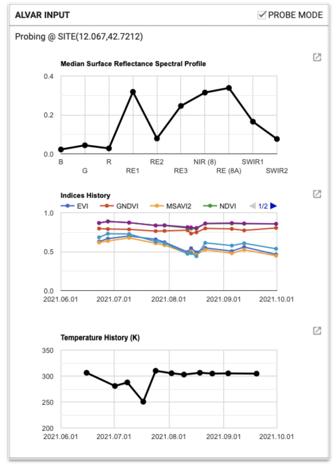
This is advised by a
CLICK ON THE SITE TO PROBE
sign box on the map window.
Probing a site shows the pixel’s spectral signature, indices time series and estimated ground temperature.
The temperature is extracted from Landsat 8 / 9 imagery. Sentinel-2 does not provide such kind of information.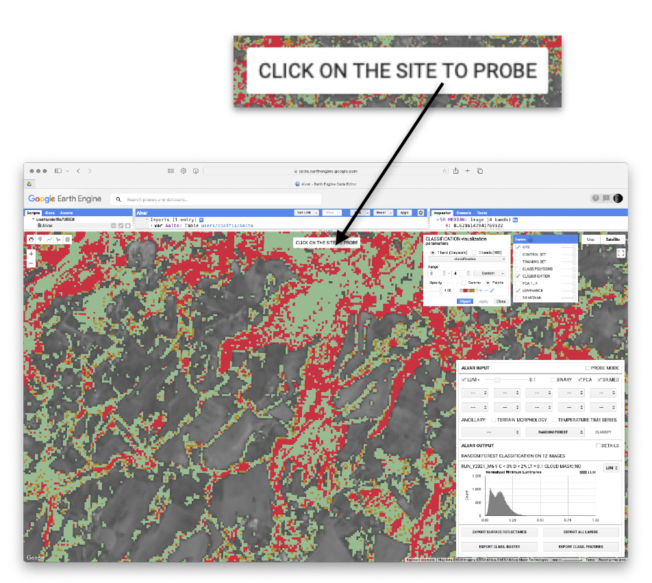
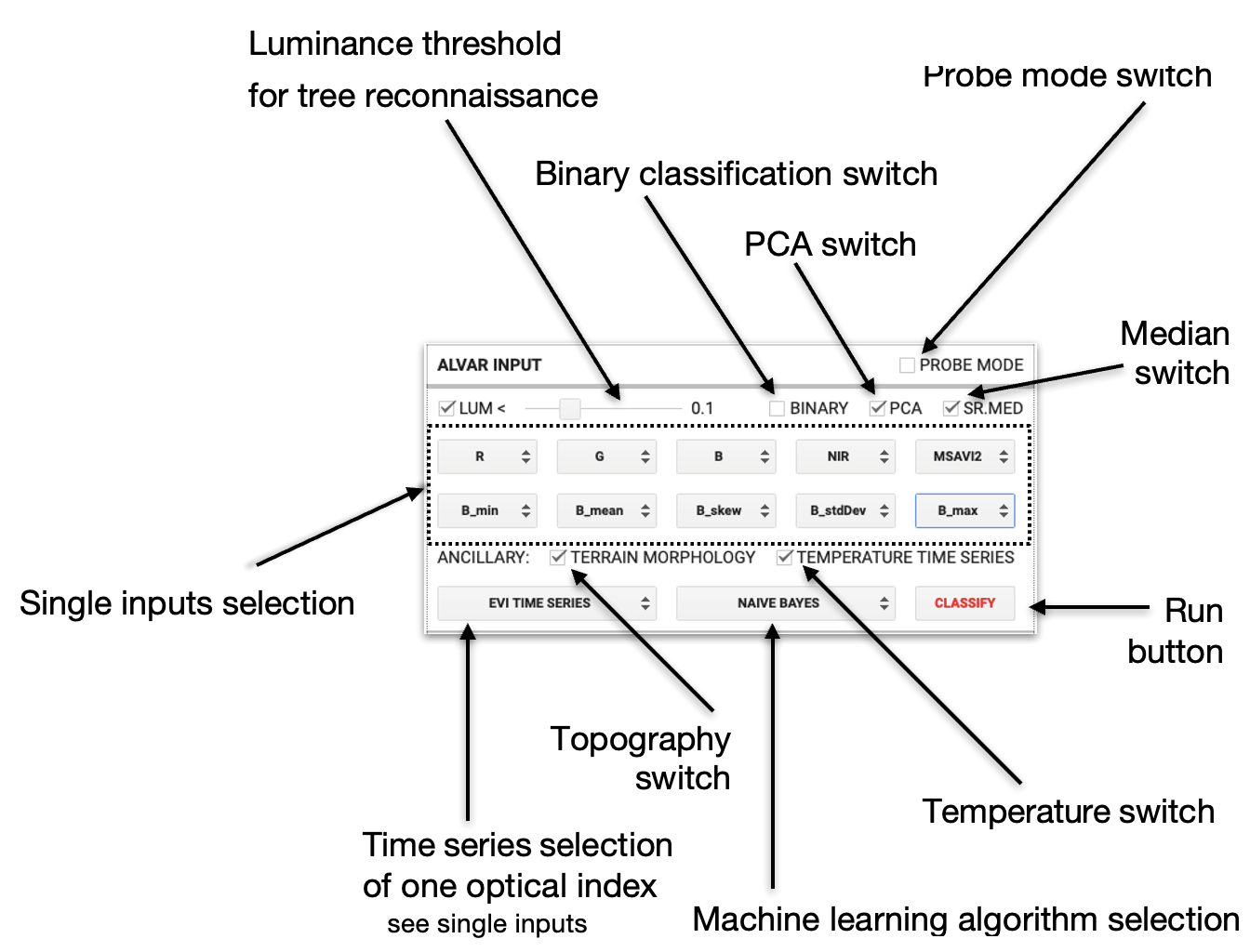 Alvar classification is performed according to the user-selected bands, indices and time series, exploiting a Google Earth Engine machine learning algorithm. If no selection is made, Alvar uses the main four principal components obtained from all the available informations.
Single inputs include all Sentinel-2 bands and band statistics (mean, median, stdev, skewness, min, max) and optical indices (NDVI, EVI, MSAVI2, NLI, GNDVI, NDVI-RE), plus soil temperature (from Landsat) and topographical parameters (ELEV, SLOPE, ASPECT).
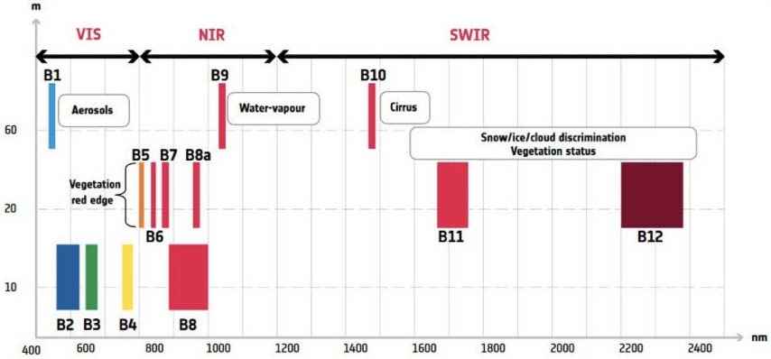
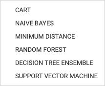
Alvar uses B2, B3, B4 (visible), B5, B6, B7, B8, B8a (NIR), B11, B12 (SWIR).
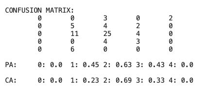
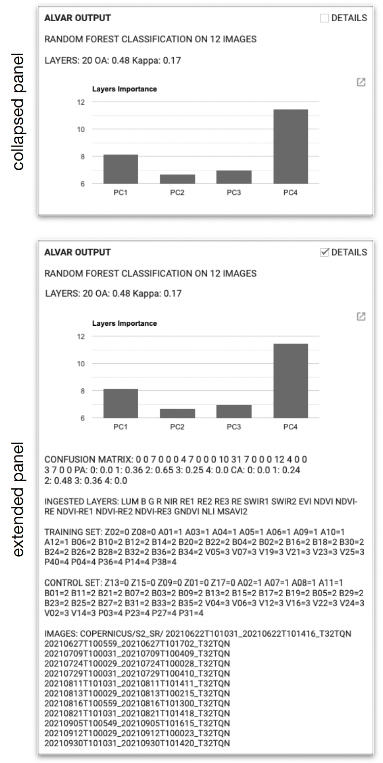 The results of the classification are shown as a usual, as the confusion matrix evaluated on the control points of the training set provided. The output panel can be expanded to show the detailed results.
Other than the classifications figures, the detailed output shows the ids of all the Sentinel-2 images within the spatial bounds satisfying the user’s constraints, the training and control points, and the user-selected layers (ingested layers).
The kappa value, confusion matrix, false positives (PA) and false negatives (CA) are written on a single line, row-wise.
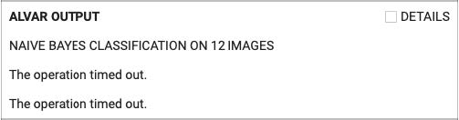
Alvar is a computationally intensive task for cloud computing. Depending on the input complexity and the current Google Earth Engine available resources, Alvar can fail to classify the conceivable A. altissima invasion areas.
Users can lighten the computational load using fewer input layers, nonetheless, time-outs often occur.
Alvar main output is a classification map. It is available both as a raster and a polygon vector layer. Other useful outputs include:
• median surface reflectance
• principal components from all layers
• median luminance for forest identification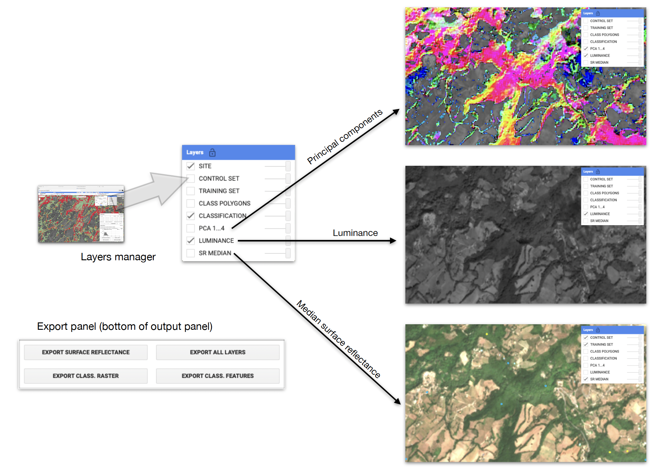
All the input and output layers can be exported as geoTiff files. The classification can also be exported as geoTiff or as a polygon vector GIS file (shapefile, table, etc).
The most important Alvar output is the classified area of interest.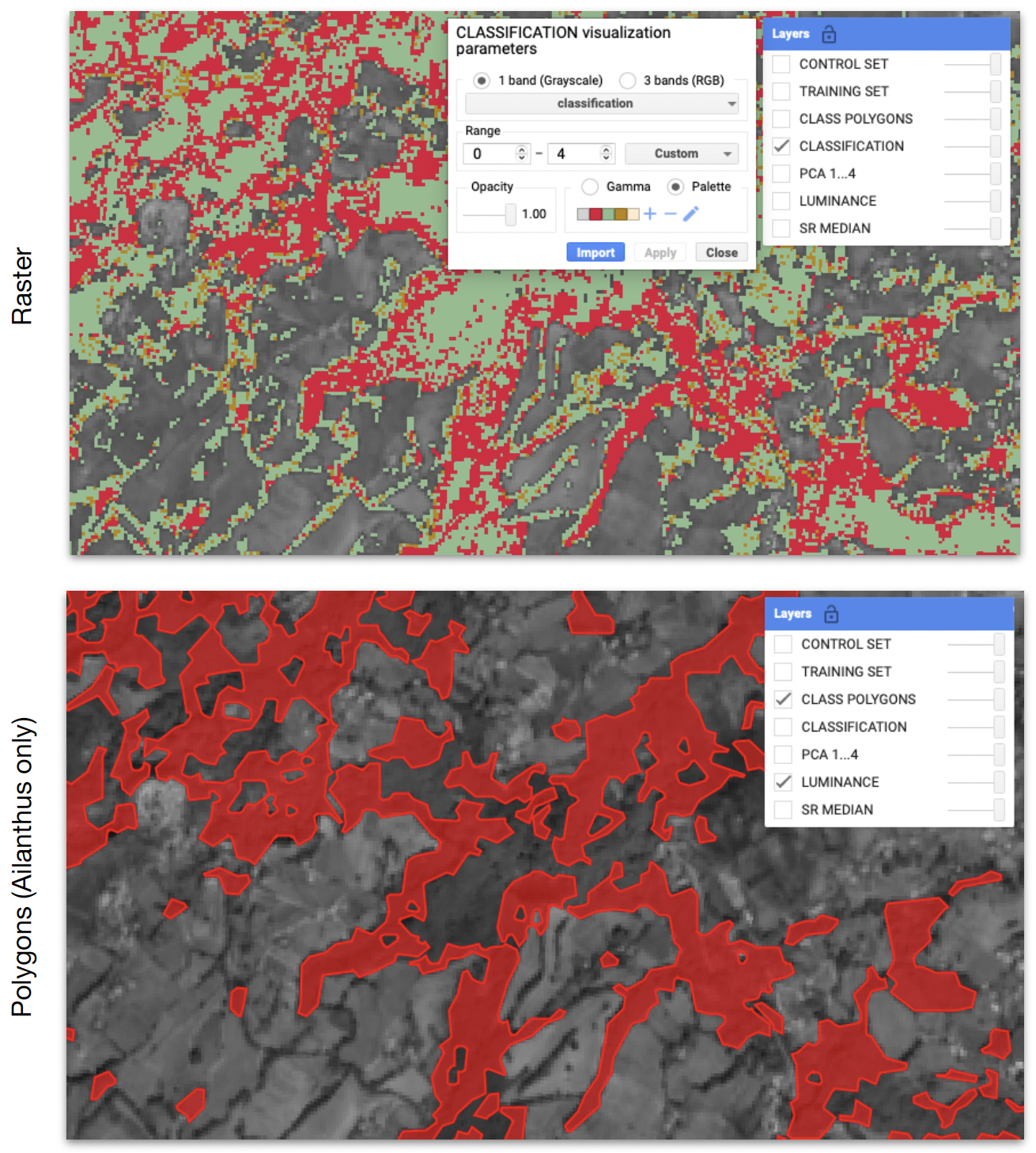
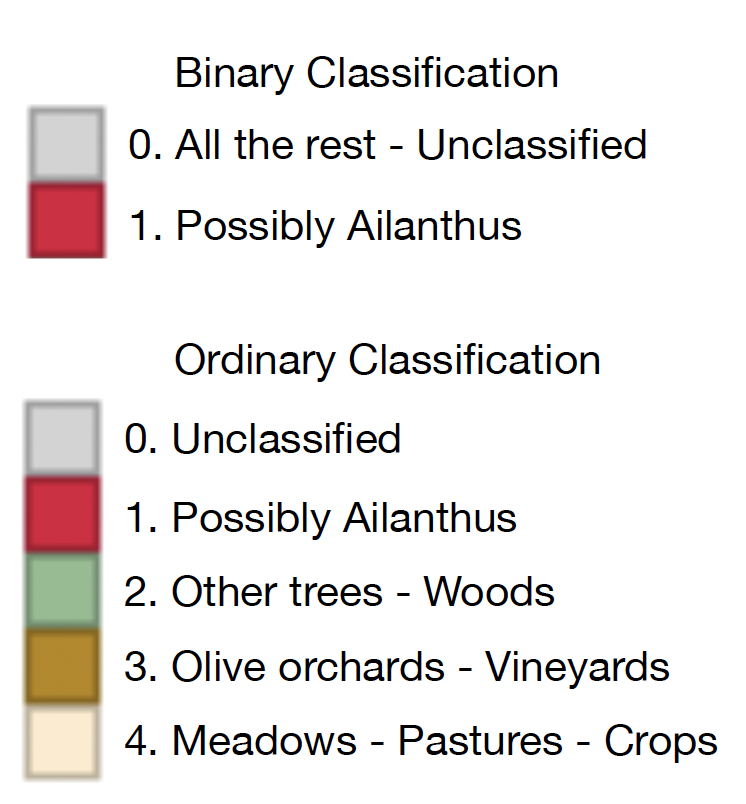
The classification output is a binary (yes/no) or multi-class 10 m resolution raster, depending on the training sample and on the status of the BINARY checkbox in the input panel.
The resulting Ailanthus class (1) is also converted to a polygon layer.
rev. 1.0 - 2024-03 - Released under the GNU GPL-3.0 license
Developed within the USEit project https://www.lifewatchitaly.eu/en/pg-related-projects/useit/
Developed by Marco Ciolfi — marco.ciolfi@cnr.it
Francesca Chiocchini — francesca.chiochini@cnr.it
Paola Pollegioni — paola.pollegioni@cnr.it
Marco Lauteri — marco.lauteri@cnr.it
Coded by Marco Ciolfi /* ciolfis */ — 0000-0003-4831-8053
Research Institute on Terrestrial Ecosystems of the National Research Council of Italy
Via Marconi 2, Porano (TR) 05018, Italy